FROM SDIS TO DATA SPACES: A NATURAL EVOLUTION TOWARDS MUNICIPAL INTELLIGENCE
For more than twenty years, Spatial Data Infrastructures (SDIs) have been the basis for organising and sharing geographic information in public administrations. However, digital transformation and the need to make the most of data have driven a new phase: Data Spaces.
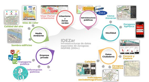
The Zaragoza City Council has been a pioneer in taking this step, evolving from its renowned IDEZar to a Data Space that unifies information management throughout the organisation. This environment not only integrates geographic data, but also connects, shares and reuses it securely and efficiently, generating value for municipal services, businesses and citizens.
The process has not been without challenges: it has been necessary to define a common methodology, integrate open source software technologies, ensure interoperability and coordinate all municipal areas under a single framework.
The benefits, however, are clear:
- Improved internal efficiency and data quality.
- Better informed and more transparent decisions.
- New digital services that leverage the intelligence of the territory.
The Zaragoza Data Space thus becomes a model of public innovation and a key step towards data-driven administration, aligned with the European strategy and FAIR principles (data that is easy to find, access, integrate and reuse).
At GEOSLAB, as the successful bidders for the Data Inventory and Data Space Development contracts, we are working both on the inventory and cataloguing of the data generated by the different departments of Zaragoza City Council and on the development of the tools necessary for its use and exploitation.
In this article El espacio de datos del Ayuntamiento de Zaragoza: más allá de Idezar published in MAPPING MAGAZINE Vol. 34, 219, 4-12 2025 ISSN: 1131-9100 explains in detail the process followed by Zaragoza City Council.


