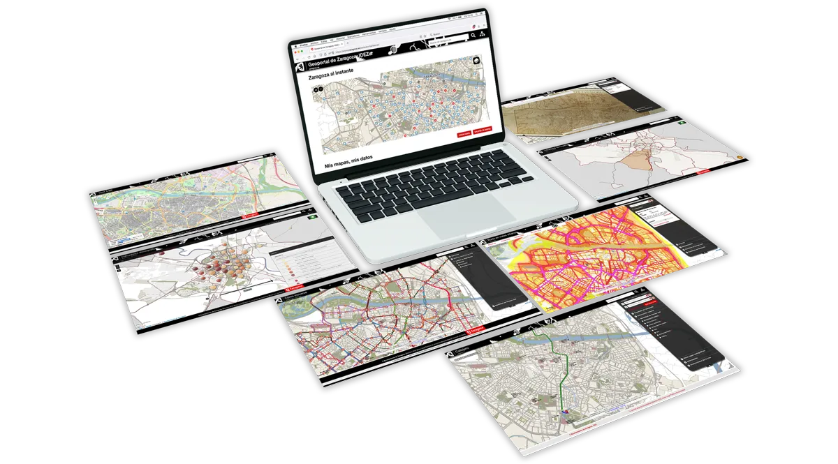
IDEZAR
The Spatial Data Infrastructure of Zaragoza (IDEZar) is an initiative born in 2004 with the main objective of providing citizens with access to information about the city located on a map.
It currently supports most of the functionalities related to the geospatial information of Zaragoza City Council. Services such as the following stand out in this regard:
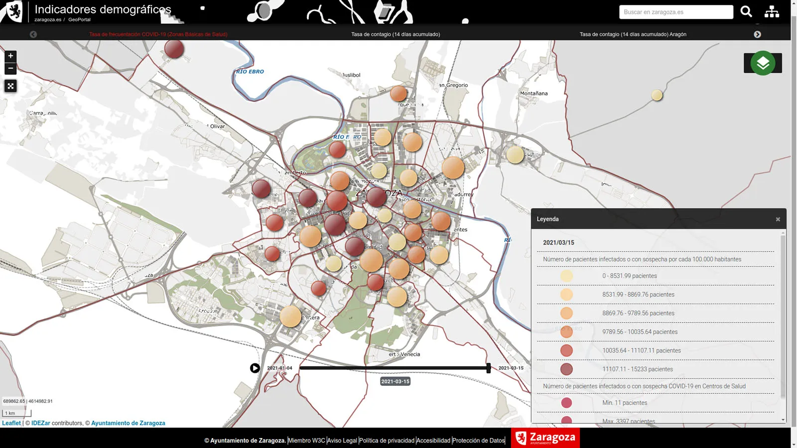
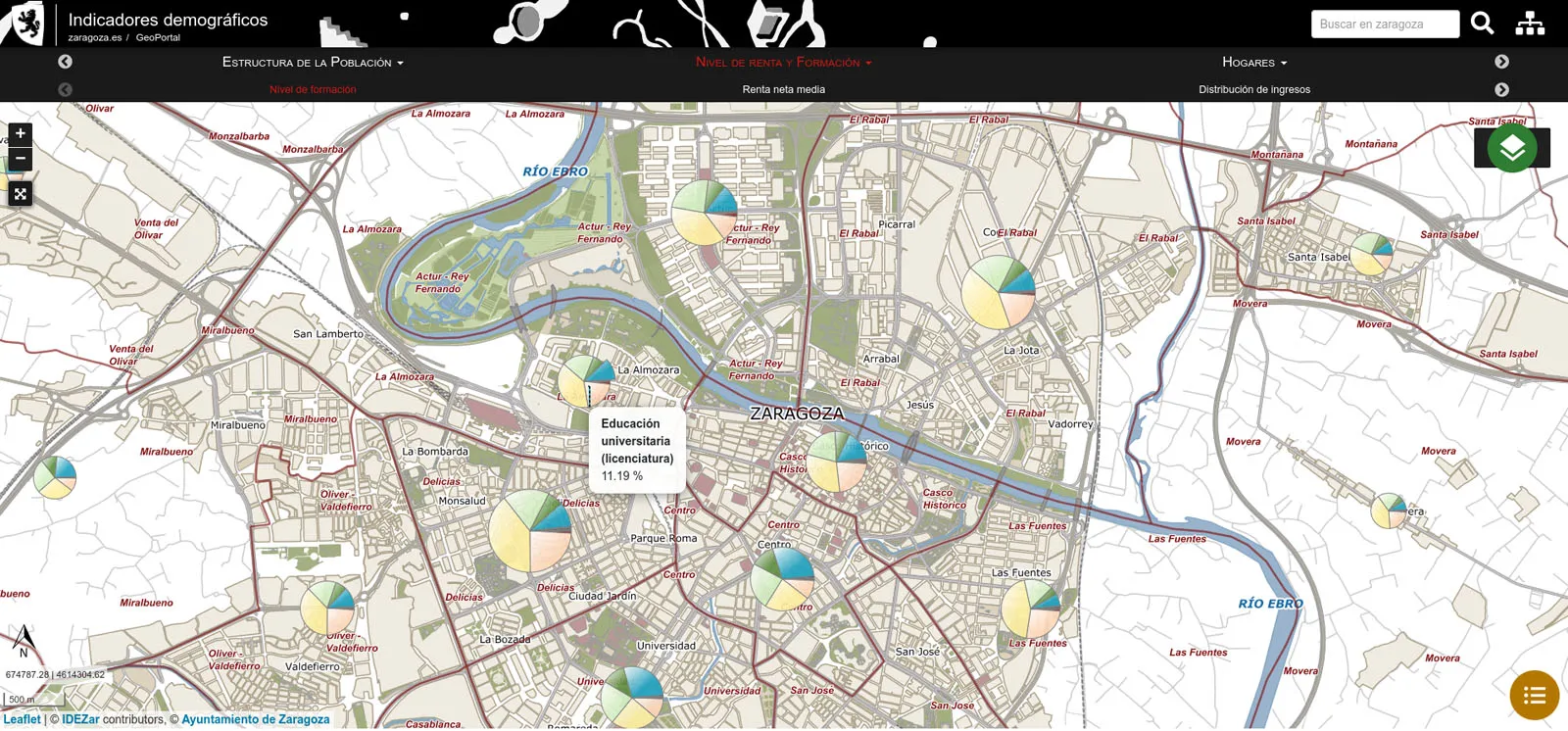
✓ Demographic indicators viewer: It allows to visualise and know the socio-demographic situation of the city in an interactive and intuitive way.
https://www.zaragoza.es/sede/portal/idezar/mapa/indicadores/
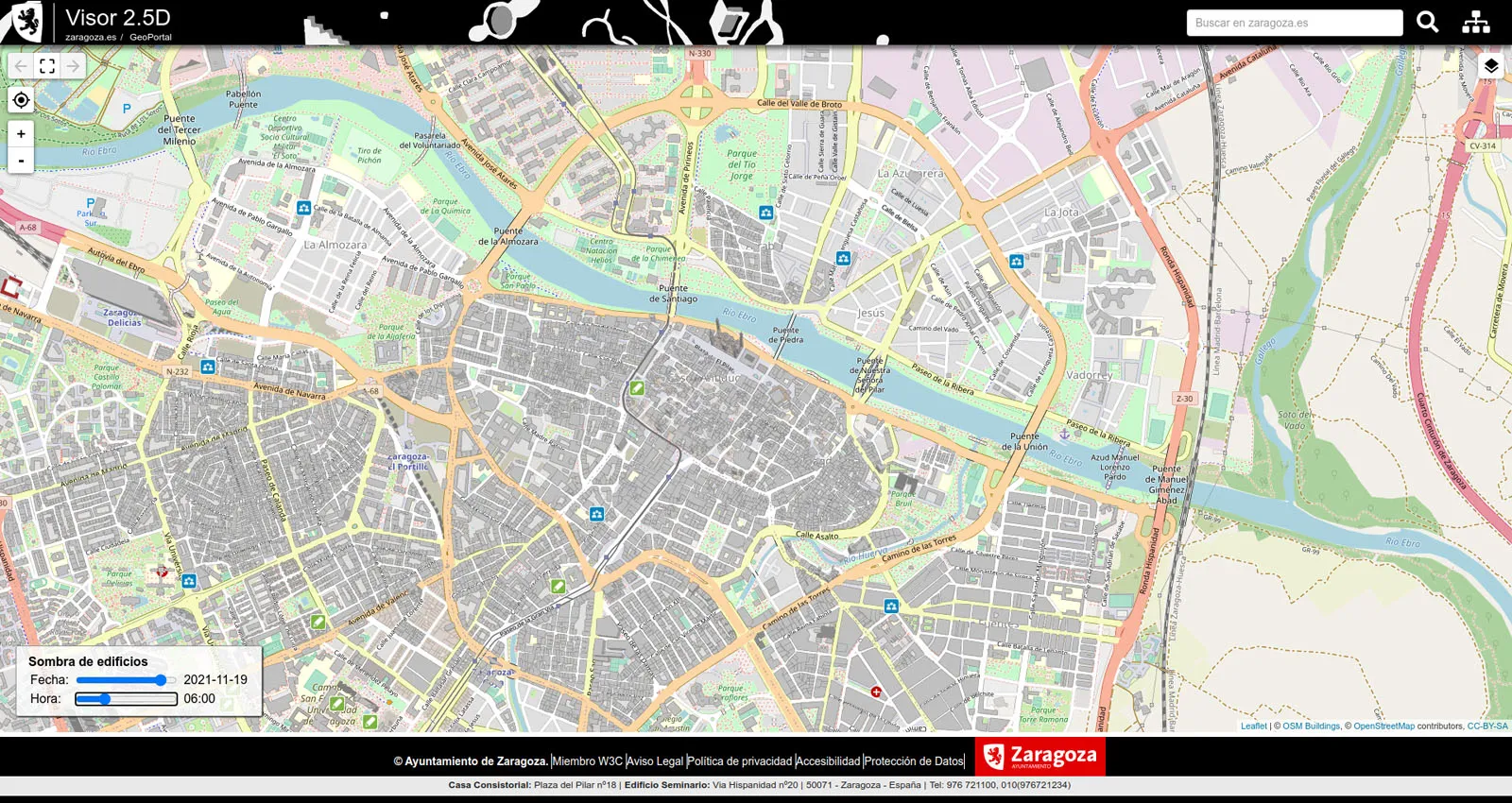
✓ City shadow viewer: shows on the map the height of buildings and the shadow they cast, which is especially useful for designing routes around the city in times of high solar radiation. It also locates the city’s facilities and offers information about them, accessing their detailed file. https://www.zaragoza.es/sede/portal/idezar/mapa/25D/
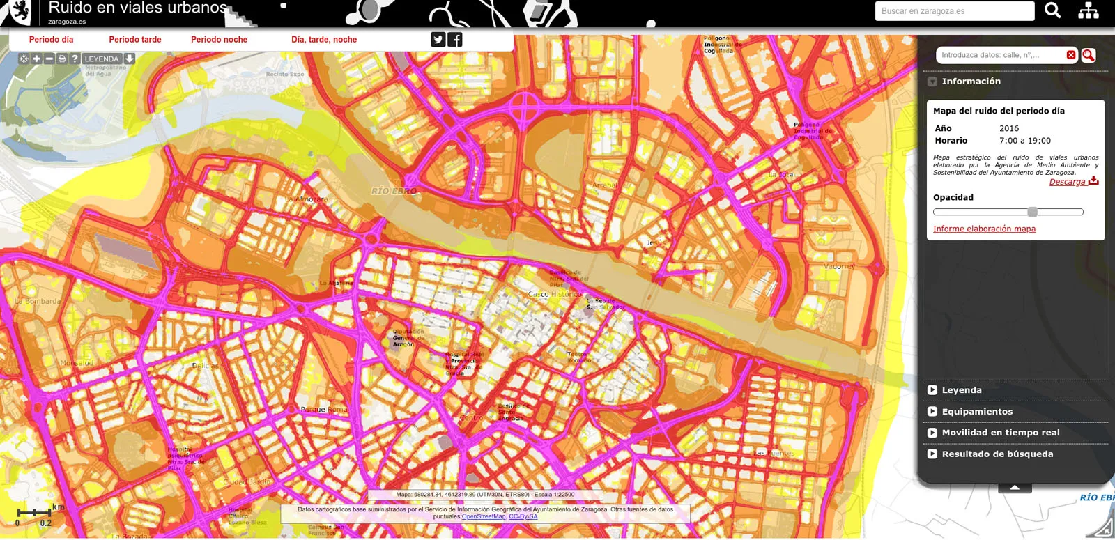
✓ Noise map. This is a tool that allows you to visualise, interactively on the map of the city, the noise levels obtained as a result of the study carried out on the noise map of urban roads in Zaragoza. The viewer shows the noise levels on the map at different times and in different areas of the city and allows other layers of information to be superimposed, such as the state of traffic or the city’s facilities. https://www.zaragoza.es/sede/portal/idezar/mapa-ruido
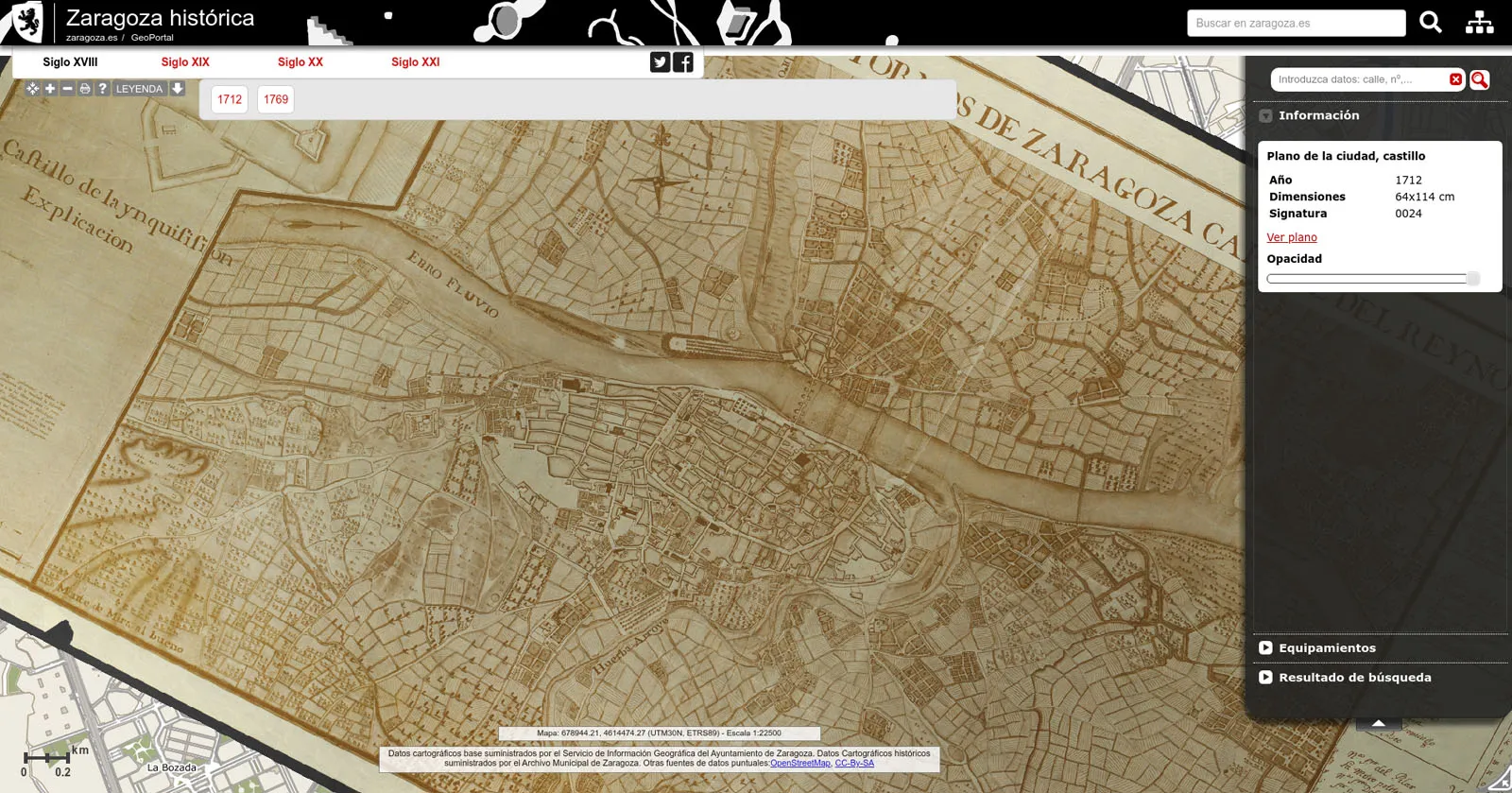
✓ Historic Zaragoza: This is an interactive viewer that allows you to superimpose a selection of historic maps from the Municipal Archives of Zaragoza and compare them with the current cartography of the city. https://www.zaragoza.es/sede/portal/idezar/mapa/historico/
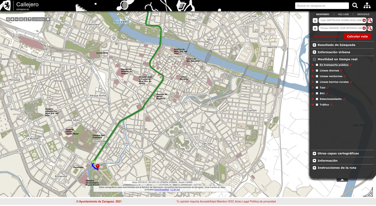
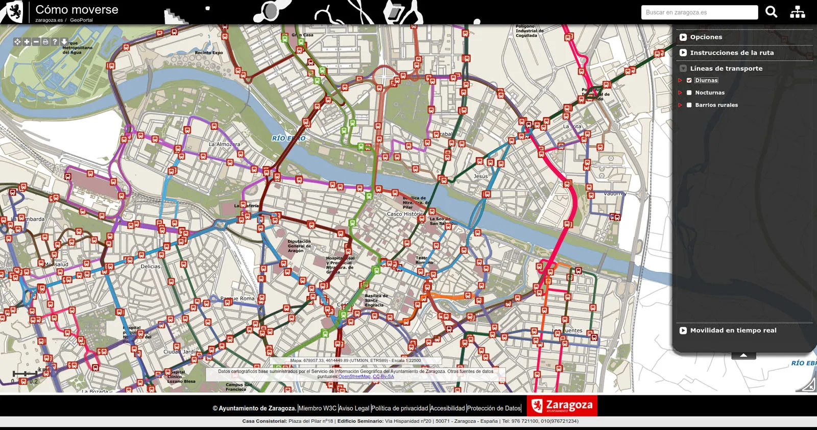
✓ Getting around Zaragoza using public transport: This is a tool that allows the calculation of personalised itineraries, taking into account route preference, time of day, traffic conditions, etc., based on real-time information, all with the aim of optimising mobility by public transport in the city.
https://www.zaragoza.es/sede/portal/idezar/mapa/comoMoverse/
IDEZAR has been designed following the European INSPIRE (INfrastructure for SPatial InfoRmation in Europe) directive and complies with the specifications of the WMS (Web Map Service) standard defined by OGC (Open Geoespatial Consortium), an international benchmark.
IDEZAR was awarded in the category of usability in the competition “EUROGI/eSDI-Net Awards 2011” promoted by the EUROGI organisation (Umbrella Organisation for Geographic Information), which aims to recognise and highlight good practices in Spatial Data Infrastructures.
✓ The Spatial Open Data Infrastructure of Zaragoza City Council (2004 -); 1st edition.
Fernández Ruíz, Mª Jesús ; Zarazaga-Soria, F. Javier (2017)
https://zaguan.unizar.es/record/60894/files/BOOK-2017-012.pdf
GEOSPATIUMLAB S.L. |
| INICIO | NUESTRO TRABAJO | - QUÉ HACEMOS | CLIENTES | NOTICIAS | CONTACTO |
| - CASOS DE ÉXITO | |||||
| - PROYECTOS | |||||
| - I+D |
| INICIO | |
| NUESTRO TRABAJO | - QUÉ HACEMOS |
| - PROYECTOS | |
| - I+D | |
| CLIENTES | |
| NOTICIAS | |
| CONTACTO |
