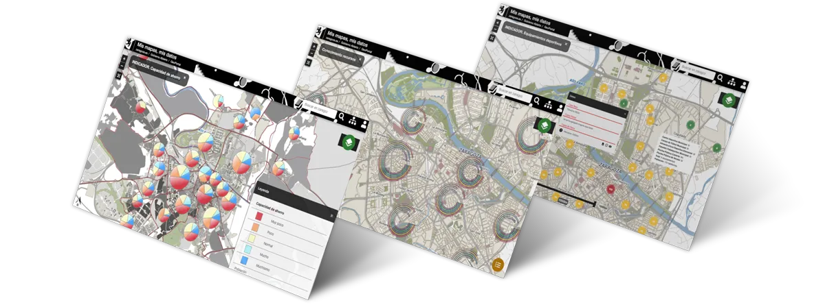
MIS MAPAS, MIS DATOS
It is a tool that allows you to design interactive maps of the city, using open data from Zaragoza City Council or from other information sources, and share them with other citizens.


In an intuitive way, users will be able to generate their own cartography on information of interest, such as drinking water sources, sports centres, noise levels or access to public transport, among others.
This information is very practical for getting to know the city in depth and can help citizens to make important decisions such as, for example, where to live.
Once the maps have been designed, users have the option of keeping them private or publishing them to share the information with the rest of the citizens, creating collaborative networks among neighbours and an ecosystem of dissemination on the platform.
GEOSPATIUMLAB S.L. |
| INICIO | NUESTRO TRABAJO | - QUÉ HACEMOS | CLIENTES | NOTICIAS | CONTACTO |
| - CASOS DE ÉXITO | |||||
| - PROYECTOS | |||||
| - I+D |
| INICIO | |
| NUESTRO TRABAJO | - QUÉ HACEMOS |
| - PROYECTOS | |
| - I+D | |
| CLIENTES | |
| NOTICIAS | |
| CONTACTO |
