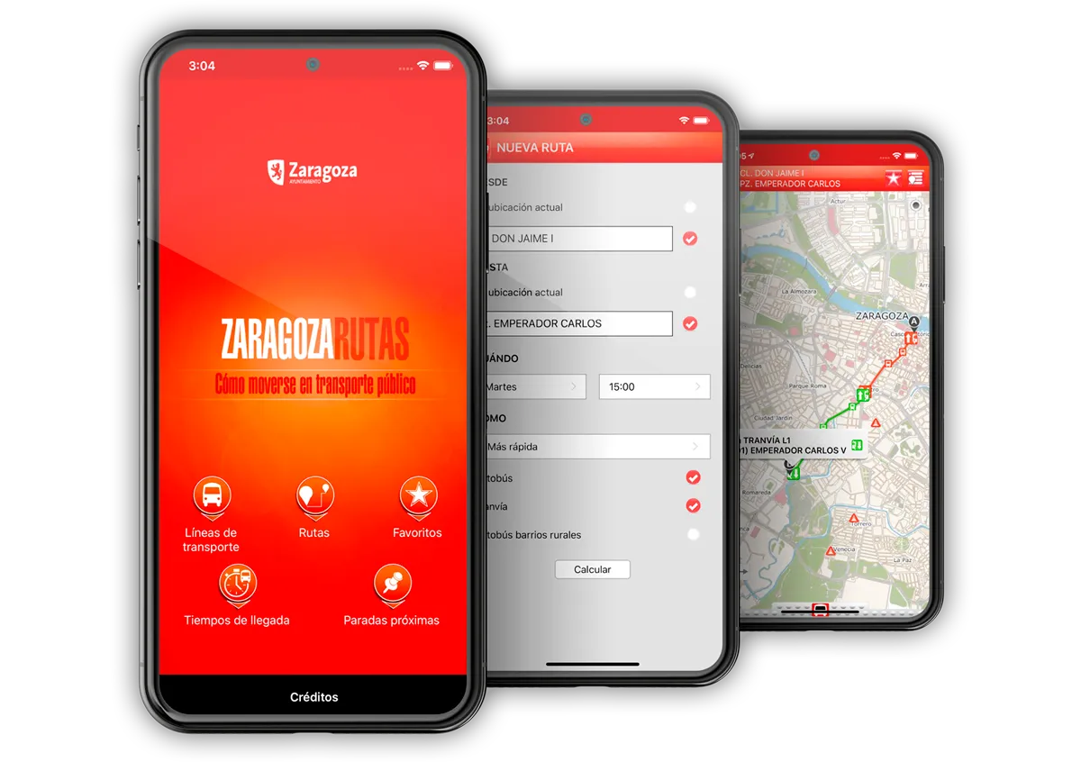

ZARAGOZA RUTAS
Official Zaragoza City Council application that allows real-time planning of journeys in the city using public transport, by calculating personalised itineraries, taking into account preferences, time of day, etc., and always with official and up-to-date information.


✓ It calculates the optimal route to move around the city by public transport according to the user’s preferences (day and time, types of transport, etc.).
✓ Provides a detailed route report, including walking trips.
✓ Displays the stops closest to the user according to their location, with a list ordered by distance.
✓ Access to the waiting time of a stop by pole number or by scanning the QR of the pole.
✓ Visualisation on an interactive map of the city’s entire public transport network.
✓ Storage of favourite routes and stops for easy access.
GEOSPATIUMLAB S.L. |   |
| INICIO | NUESTRO TRABAJO | - QUÉ HACEMOS | CLIENTES | NOTICIAS | CONTACTO |
| - CASOS DE ÉXITO | |||||
| - PROYECTOS | |||||
| - I+D |
| INICIO | |
| NUESTRO TRABAJO | - QUÉ HACEMOS |
| - PROYECTOS | |
| - I+D | |
| CLIENTES | |
| NOTICIAS | |
| CONTACTO |